


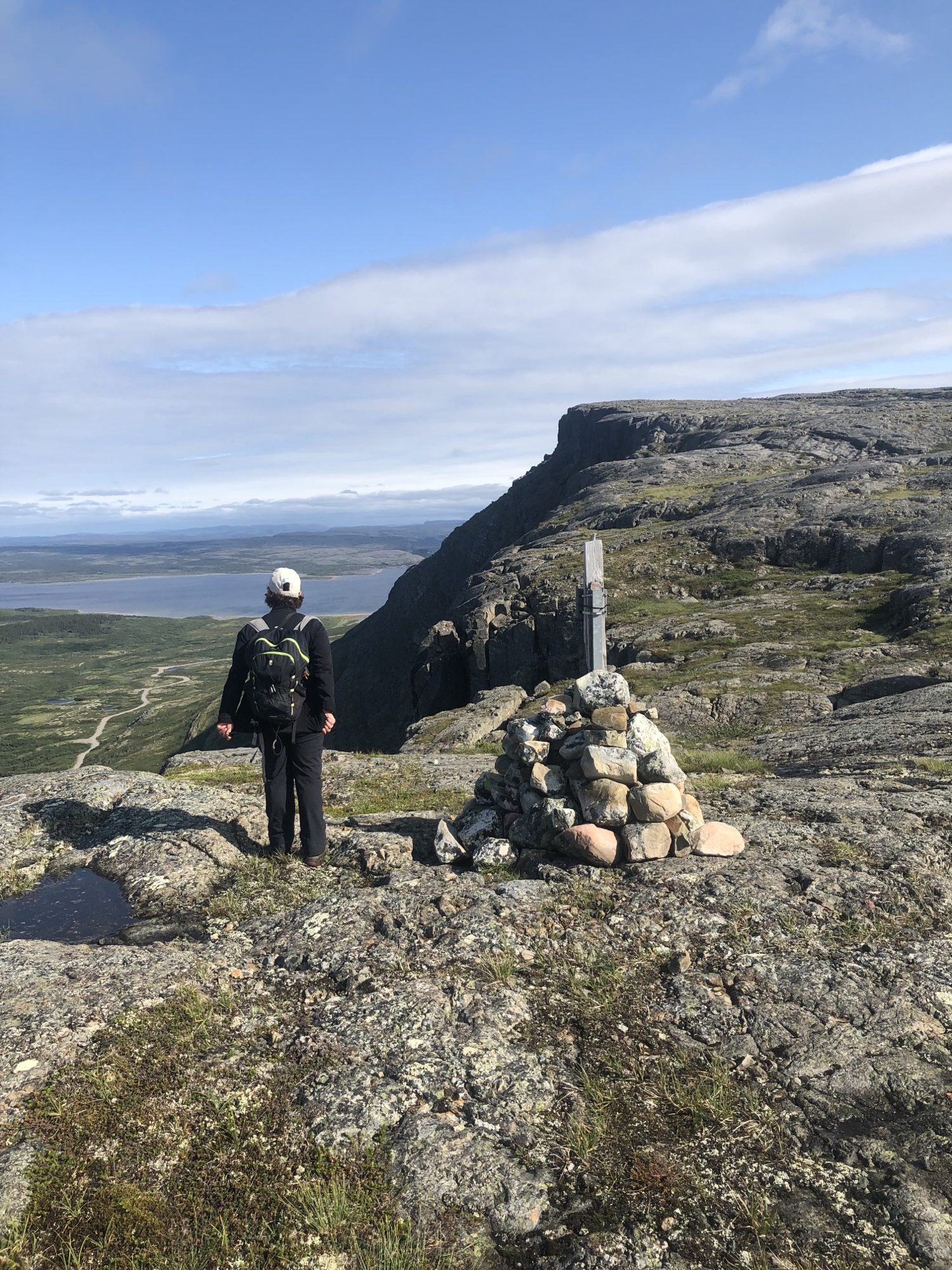
A Laval University researcher stands atop the Tasiapik Valley, overlooking the road that leads to Umiujaq. (Photo credit of Jérémy Grenier)
Researchers find what causes avalanches in Umiujaq
A collection of 40,000 pictures of the Tasiapik Valley help determine conditions ripe for disaster

A Laval University research team has identified the weather conditions that cause avalanches in the Tasiapik Valley, near Umiujaq, by examining 40,000 pictures.
Their goal is to be able to predict these disasters and avoid tragedies like the 1999 avalanche that struck Kangiqsualujjuaq’s gym where festivities were being held, killing nine people.
Jérémy Grenier, studying for his master’s degree in geographical sciences, installed motion-sensing cameras across the valley, similar to cameras used to capture wildlife. During three winter seasons, the cameras took 40,000 individual photos and documented 130 events considered to be avalanches.
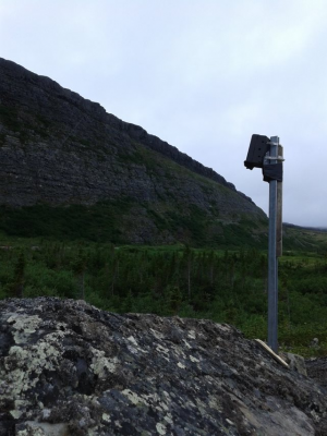
A camera pointed at a hillside is prepared to capture images of avalanches. (Photo courtesy of Armelle Decaulne)
“What we were doing is trying to identify weather conditions that were favourable for avalanches to happen,” he said in a video call interview. “I looked at the photos one by one and was able to build a database out of them.”
Grenier was helped by Laval University’s northern research branch, Centre d’Études Nordiques. There, he gathered detailed weather information for Umiujaq.
What Grenier’s study demonstrated was that avalanches were most likely to happen in winter after a snowfall that lasts more than three days, with more than 10 centimetres of snowfall in total.

In spring, avalanches are caused by warming weather. But as soon as the temperature climbs above 0 C, the risk starts to diminish.
To Grenier, the study of avalanches, especially in the Tasiapik Valley, could save lives. He pointed to one road near a slope as an example: he said his cameras caught footage of avalanches that were able to reach this particular road.
“It could hit someone,” he said. “The probabilities exist.”
Climate change is also a variable and might influence the frequency and intensity of avalanches in the future. More thawing and milder weather has an impact on the density of snowpack, and can create weaker layers that can break away and cause avalanches.
“This is where research becomes important, we are right in it,” Grenier said. “We are right in the midst of climate change, and it is important to understand what might happen to avoid tragedies.”
The team behind this project intends to extend its research across Nunavik. The communities researchers believe are most vulnerable to avalanches are Inukjuak, Kangirsuk, Kangiqsujuaq, Quaqtaq and Salluit.

Grenier said his team’s research may lead to a prevention system similar to forest fire prevention systems that are in place now.
For instance, a sign at the entrance of a valley with an easy-to-read risk meter with options like “no threat” to “highest chance of avalanche” could help, he said.
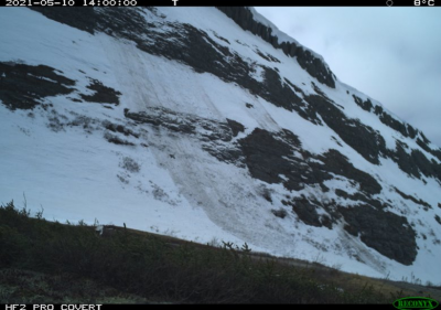
A photo of an avalanche on one of Tasiapik Valley’s slopes. (Photo courtesy of Jérémy Grenier)
The team is also looking to implement community involvement into its research. There could potentially be a platform where communities can share avalanche occurrences with a photo to add to the overall database.
“I loved the collaboration we had with the people,” Grenier said.

“They are always there to wave at us and encourage us in our projects. We don’t come pretending to know everything, we want to speak with locals, we want to know what they know.”
There are glacier calving time lapse photos that scientists have/are recording, it’s impressive.