


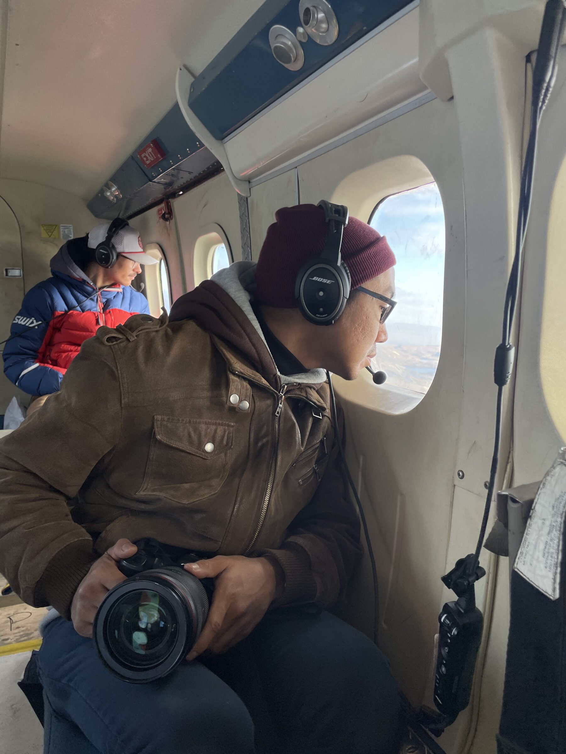
Usaaraq Jari Aariak of Iqaluit, front, and Camille Lavallée of Arctic Bay look out the window of a de Havilland twin otter while surveying Atlantic walrus in August 2025. (Photo by Travis Qaunaq/DFO)
Researchers take 300,000 photos to focus on walrus numbers
Foxe Basin, Hudson Bay-Davis Strait populations in scope ahead of anticipated shipping increase in area
It took 17 days, three de Havilland Twin Otter planes, and two kinds of camera lenses for the Department of Fisheries and Oceans to complete its largest-ever aerial walrus survey. Now, the team of researchers is looking to complete its findings by the end of the year.
In August 2025, research scientist Cory Matthews and his colleagues snapped 292,000 photos of two Atlantic walrus populations — the Foxe Basin stock and the Hudson Bay-Davis Strait stock, to the west and south of Baffin Island. To do it, the team flew more than 22,000 kilometres of Nunavut’s coastline at an altitude of 305 metres.
“We haven’t done that large of an area all at once ever, really,” Matthews said in an interview. “It was a big accomplishment.”
There were three reasons for the undertaking, he said.
First was to update the mammal’s population numbers, which the department aims to do every five to 10 years.
Second, the department wanted to capture Hudson Bay-Davis Strait walrus along with the Foxe Basin stock at once, to account for any migration. There have been doubts over previous counts because researchers believed the walruses could be moving between the two areas.
Third was to come up with baseline numbers. While the stock is perfectly healthy, there is some concern the anticipated increases in shipping “related to industry” in the area over the next several years may affect it, Matthews said.

“We’re trying to get a really good handle on what the situation looks like now so that we can sort of track whether or not there’s any negative impact,” he said.
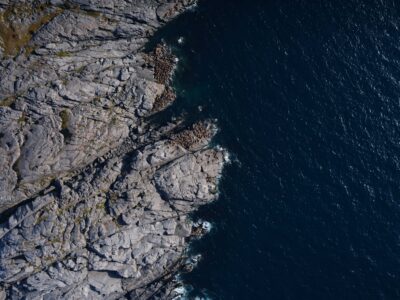
How many walruses can you spot? This photo is one of 292,000 Department of Fisheries and Oceans researchers captured during their survey of Atlantic walrus populations near Baffin Island. (Photo courtesy of Cory Matthews/DFO)
In the belly of each plane was a glass dome, in which a digital camera with either a 35-mm or 55-mm lens hung face down, taking pictures once every three seconds. There were camera operators, as well as observers, who spotted walruses to mark the photos in which they appeared.
During the analysis phase, which Matthews said he and his team are currently in, they look at 100 photos taken before and after the marked photo to ensure they don’t miss any animals.
Then they count.
“Often we’ll play around and adjust the contrast and lighting to accentuate them a bit,” Matthews said. “A lot of times they’re clumped in really, really dense groups and it’s hard to tell if that walrus’s head or its body is part of another one or if it’s one animal.”

“If it’s a large number of walruses, there’s going to be some disagreement just because it’s almost impossible.”
Next, the researchers account for walruses that might have been swimming and out of the camera’s view.
To do that, department officials used a crossbow to implant nine walruses near Coral Harbour and nine near Igloolik with a satellite tag. The device, two-inches long and shaped like an oval, sticks into the blubber on the back of a walrus’s neck.
The tag tells researchers how long the animal spends wet and dry, which equates to how much time it spends on land (typically 30 per cent) and in water (typically 70 per cent). Scientists use this data to adjust their counts.
Three Inuit from Arctic Bay, Kinngait and Igloolik are participating in the project, Matthews said. They received sighting, camera and computer training, and two of the three continue to work with the department analyzing the data.

Matthews expects the team to finish counting by the end of this year. After that, they will have an internal peer review process before the results are published.
You have close to 500 in photo just on land
Walrus was made extinct in Iceland in the 13th century due to overhunting.
The largest population of walrus in the world was extirpated from PEI, Nova Scotia, and the Gulf of St. Lawrence in the mid 19th century due to overhunting.
Walrus in West Greenland are heavily depleted due to overhunting and small vessel traffic and people disturbing shoreline haul-out sites. East Greenland walrus are doing better due to protected shore haul-outs in their National Park.
Pacific walrus in Alaska were severely overhunted in the 19th century and have rebounded due to strict American harvest controls.
The status of walrus in Russia is uncertain, but it is known that the populations there were probably continuous at one time, but are now fragmented due to historic overhunting.
Throughout the history of people interacting the walrus, the main thing we seem to do is kill too many of them.
The most recent Alaskan research (2023) trying to find effects of commercial shipping on walrus, used 218 tagged walrus, and found no negative effects past 15 km proximity to concentrations of walrus. These findings can easily be used to implement regulations for commercial cargo traffic to avoid concentrations of walrus.
Documented cases of shipping disturbance of walrus haul outs have involved tourism operations, not commercial cargo vessels.
Clearly, the reasons DFO would say commercial shipping is a concern for this species is not rooted in science.
They say this because they involve Inuit harvesters in their research, and do not want to offend those that have been demonstrated to be the biggest risk to this species.
And, they needed to come up with some new problem in order to get their study funded by conveniently ignoring much bigger and more statistically sound studies done by the Alaskans.