

Fall outlook predicts above-normal temperatures for parts of Nunavut, Nunavik
Nunavut’s Baker Lake region may see below normal levels

This map from the Weather Network shows how fall 2013 temperature trends look.
Some parts of Nunavut and Nunavik can look forward to warmer-than-average weather over the next three months, according to the Weather Network’s meteorologists, who released their fall forecast Aug. 27.
Their fall outlook, forecasting weather for the months of September, October and November, predicts above normal temperatures for much of northern Baffin Island and parts of the Kitikmeot region in Nunavut as well as for the southern Hudson Bay region of Nunavik.
However, temperatures will dip lightly below normal in a large area centered around Baker Lake in Nunavut’s Kivalliq region..
More precipitation is forecast to fall across the Baffin region into the Kitikmeot region, and in areas of the Hudson and Ungava bays of Nunavik.
In Iqaluit, temperatures will stay near normal, with an average high of -1.4 C and a low of -7.4 C, and 115.6 mm of precipitation in the forecast.
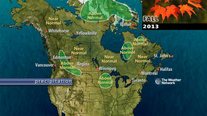
This map from the Weather Network shows how fall 2013 precipitation trends look.

(0) Comments